Showing posts with label XinJiang. Show all posts

Our Trip to XinJiang: Part 14 of 14

Day 18:
We woke up that morning, had breakfast in Hami and were on our way to Turpan.  Our goal was to travel ~427 km to Tuyugou Valley to visit the Mazar Village otherwise known as Tuyuq (吐峪溝) at the edge of Turpan, then to the Ancient City of Gaochang (高昌故城), before ending the night in Turpan (吐鲁番).

What's interesting about the Tuyugou Valley is that it sat within the Turpan Depression that is known to be the second or third lowest point on Earth and houses many historic sites easily going back 3000 years.  The Mazar Village is one of these historical sites. It is said that there is a holy cave at the Mazar Village that is documented in the Koran.  

Legend has it that two missionaries entered XinJiang in hopes of spreading the Islamic faith.  However, they were soon hunted by the miliary.  The two missionaries came upon a pair of shepherds and their dog.  After some conversation with the missionaries, the shepherds decided to help them escape.  After several days, maybe even weeks, they were running short on supplies and the shepherds wanted their dog to leave and run to freedom.  However, the loyal dog would not stop following.  The shepherds got desperate and crippled the dog to leave him behind, but still he would follow.  In the end, they hid in a cave with the dog as their guardian; and that was how the holy cave came to be.


The view from up top; we had to climb a steep sandy hill at the edge of the village to get to this photographic point.  The descent was rather interesting as the dry sand made it ridiculously slippery even though I was in my sneakers.  Annie's descent was most memorable as she was in her sandals, screaming, giggling, and sliding.


Kel crept out to the edge for his photos; I  wouldn't dare as I could foresee myself slipping and rolling down every which way.


The other side of the village where the pond is; you can see the Buddha Grottoes in the mountains.  However, they are no longer open to the public due to damage done over the years.  Another memorable thing about the village is that there's a murky creek that runs through it to this pond; like the water was actually brown.  And the villagers actually use this as their drinking water.  Our guide told us that the locals would have to let the water sit in their bucket overnight for the sediments to settle before using it.


Did I mention the village is saturated with mulberry trees?  We've never had mulberries before; I for one have only read about them in books.  Our guide told us to try them and at first we were skeptical, but once we had our first, there was no stopping us!  (Or me and Annie that is..)  The guide couldn't help but laugh as we ate our way through the village.


We saw a man butcher a goat in his front yard; and by butcher I mean literally empty the goat's intestines as his pet cat watched.  On the right is the house the locals has preserved as it is believed the missionaries, shepherds and the dog has stayed there before.


Next, we headed to the Ancient City of Gaochang (高昌故城).  This ancient city dates back to 100 BC and used to be an important trading post along the Silk Road.  The city was said to have been burnt down in the 14th century.

We had to pay admission to get a mule driven wagon to take us in.  There wasn't a whole lot to see, as it was no more spectacular than any of the other ancient ruins we've seen on this trip.  If anything, this one was even less maintained.  The negative experience we had with this particular site was that the locals there tried to scam us and make us pay double.  When we got to the main part, they informed us that what we previously paid was a one way trip and that we needed to pay again to get driven back out.  Annie argued with them for a bit and then we just ignored them and walked into the site.  They were still there waiting for us afterwards to drive us back out, but nonetheless it left a bad taste in our mouth.


We returned to Turpan that night for our last dinner in Xinjiang.  We celebrated our trip with good food, cold beers, in good company.


Day 19:
We woke up in Turpan and had breakfast before driving back to Urumqi, where we were to depart XinJiang in the afternoon.  Throughout the drive, we were recalling all that we've seen and experienced in the last three weeks, saying farewell to the camels as we passed by; the mountain; the goats.

After having lunch in Urumqi, Siubo said we still had a little time before our flight and asked if there was anything we wanted to do.  For some reason, Starbucks came to mind.  There was supposedly one in Urumqi, or so Siubo has heard of.  We had tried looking for the location of it online during our trip, as a friend had asked if we can bring back one of their mugs from the World collection, but had no luck.  Nonetheless, we figured if there was one, it'd be pretty cool to bring one back for ourselves that said "Urumqi" or even "XinJiang" on it.  Siubo called around and located a "Starbucks Cafe and Restaurant".  It didn't sound right, but since we had time, we decided to take a detour.  Or rather, Siubo insisted on checking it out.  (Did I mention he was a wonderful driver? :)  Alas, when we got there, it turned out to be a restaurant that used the Starbucks name and since Starbucks never had a location in XinJiang, it wasn't an issue.  And that was our last adventure before Siubo dropped us off at the airport.


Our 19 day road trip through Xinjiang (and a part of Gansu) covered an approximate distance of 6973 km.  That's more than 1000 km above the distance needed to travel across Canada from Victoria, British Columbia to Halifax, Nova Scotia!  Below, I've put together a map of the route we took during our trip and yes, it was quite an adventure!  So much so, that we've decided to go back next year (which is really this year, since I started this post in October and it's now regrettably January)!  Cannot wait for part 2!

A-Urumqi; B-Yuli; C-Korla; D-Kuqa; E-Kezi'erxiang; F-Aksu; G-Kashgar; H-Taxkorgan; I-Khūnjerāb Pass; J-Kashgar;
K-Hotan; L-Minfeng; M-Korla; N-Turpan; O-Dunhuang; P-Jiayuguan; Q-Hami; R-Balikun; S-Turpan; T-Urumqi

Our Trip to XinJiang: Part 13 of 14

 Day 16:
We woke up in Jiayuguan (嘉峪關) that day, had breakfast and made our way back to Hami, otherwise known as Kumul (哈密) in XinJiang province.  Once again, we only stopped for meals and washroom breaks, travelling 611 kilometers over ten hours.  Hami was a much bigger city than the others we've been to in our previous days.  It actually had a modern four star hotel!  Although it was more than double the price of the previous hotels we stayed in, Kel and I decided to stay a night and enjoy a long, hot shower.  After all, it was still ridiculously cheap compared to North American standards.  The only complaint we had was once again, because its a newer hotel, it was central air.  This meant we didn't have absolute control over the temperature in the room and it was warmer than we'd prefer.


Day 17:
We spent the day in Hami.  After breakfast, we headed out to the Devil City (哈密魔鬼城).  There weren't actually any devils there, but more like rock formations in the Gobi desert.  The reason it was dubbed as the Devil City was the howling sounds that can be heard in the dead of the night.  The Devil City is about 5-10 kilometers in width and has a span of 400 kilometers from the Camel Peak to the Wubao Shaer Lake.  Because it is so vast, we had to pay an entry fee and then drive in as opposed to walking.  We found rock formations within that took the likings of a turtle, a chess piece, and the ruins of an ancient castle.

The giant sea turtle.


The knight chess piece.


Below: We hiked up the fortress ruins for more photo ops!  The view at the top was stunning.


On the way back, we did a quick stop to take pictures at the Border Mound Beacon by Shibaohua (史保華).  There really wasn't much there, but this beacon, so we quickly took some pictures and left.


Next, we headed up to Balikun (巴里坤) to see it's famous grasslands (巴里坤草原), the White Stone Scenic Spot (白石頭風景區) and the Balikun Lake.  Siubo wasn't too enthusiastic about taking us up to Balikun because it was 142 kilometres north of Hami, which is a good three and a half hours to get there.  We were staying the night in Hami, which meant it adds another seven hours of commute time!  He assured us there wasn't anything worth seeing up there.  However, Flora found a picture of the Balikun Lake in one of the travel brochures at the hotel the night before and we were convinced to find it.  In the picture, there was the grasslands around the clear turquoise lake, and in the backdrop there were green trees and snow capped mountains peeking through.

On the way up we stopped at the side of the road for pictures, as we were approaching the mountains and there was a creek running alongside. It was all too beautiful!


And this is when we got up to the Balikun grasslands (巴里坤草原).  Siubo said it was still too early in the season as it will get much greener in another month of so time.  It was such a nice day and on the right there, you can see the little trees they've planted in the field.


We didn't end up taking any pictures, nor did we stop at the White Stone Scenic Spot (白石頭風景區) because it's become highly commercialized with resorts and such.  Siubo agreed that the commercialization of the scenic spot has caused such an eyesore that it's no longer worth going.  On passing by we could only agree, as once again, mankind has destroyed what was once so beautiful purely for the sake of trying to make a few bucks.  Similarly, we never did find the Balikun Lake as framed in the picture.  We saw the Balikun Lake, but it's backdrop was not what was in the brochure.  It's neighbouring lake had that snow capped mountain backdrop, but lacked the grasslands.  We, along with Siubo, was convinced that someone must have photoshopped the two into one picture to use for marketing purposes.  Siubo goes up there many times a year, and says he has never seen all of those characteristics by one lake.

We went the rest of the way up to the Balikun town, but there wasn't much to see there.  It was all very touristy, and not at all what we were looking for.  There was an old wall at one end that was supposed to be a good picture spot.  However, when we approached, a lady tried to sell us counterfeit entry tickets, which left a sour taste in our mouths.  We talked her price down and sent Flora up the wall to see if it was even worth the time or the money for the rest of us to go up.  She reported back saying the pictures seen in the marketing brochures must have been taken from the other side of the wall.  There was no way down the other side unless you scaled it, and it was just barren desert land there.  All in all, we admitted to Siubo, we felt pretty fooled and the few pictures we did take was definitely not worth the seven hour drive.

Our Trip to XinJiang: Part 12 of Many 14

Day 15:
We got up in Jiayuguan (嘉峪關) excited for our day of adventures.  There were three major sites waiting for us that day.  The first was Jiayuguan Pass (嘉峪關關城), noted as the first pass on the west end of the Great Wall.  It is also the last pass people would see after getting banished to the west.  Legend has it that it was so meticulously planned that the government official in charge demanded the designer to itemized all the materials he would need down to the last brick.  After the architect provided the general with a number, he asked if the architect was sure.  To humor the general, he added one brick to his estimate.  When the pass was finished, there was indeed one brick left.  The architect told the general to use it as a door stopper.  To this day, there is one loose brick at Jiayuguan Pass.


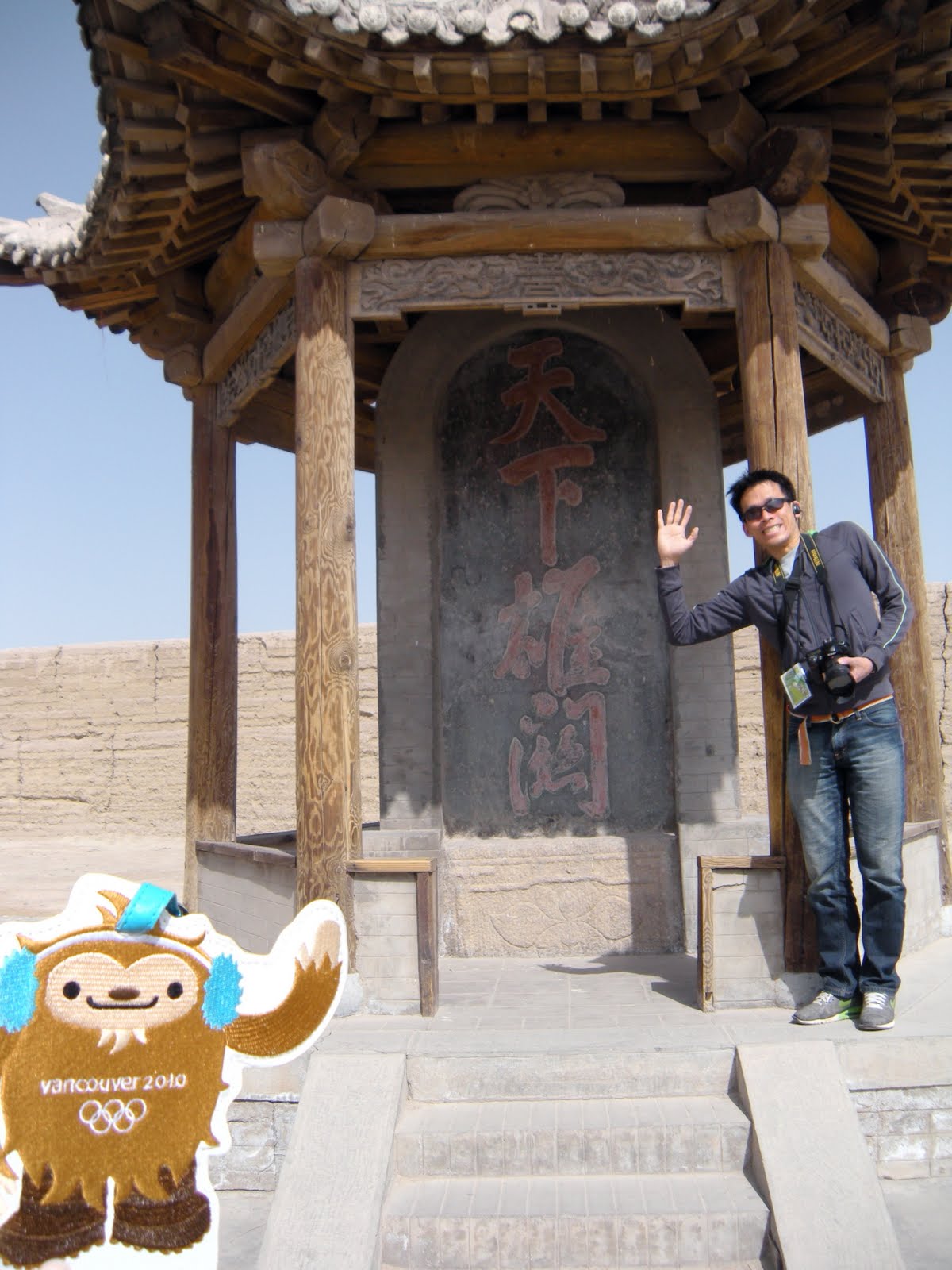
Below: Quatchi and Kel at Jiayuguan Pass

Below: One of the towers at the end of the pass.


We spent the majority of our morning at Jiayuguan Pass before heading to an early lunch. 
After, we headed to what is known as The First Pillar (天下第一墩).  It is the most western end of what was the Great Wall.  It served as a natural ending as it ended in a gorge with a river going through it.  There was a military outpost on the other side of the gorge, which could be reached by a suspension bridge.  For tourism purposes, they've installed another way to cross over: a zipline!  We debated for a little bit whether we wanted to ride the zipline across.  The fee for it was minimal, but this is China afterall.  Did we trust their safety precautions?  We finally decided that we were likely never to come back so, might as well!

You can see the suspension bridge over the gorge.

A close up of the military outpost.

The view of the gorge from a glass platform built out from the higher end.

Kelly on the zipline, ready to launch!

Me flying across the zipline arms out, laughing all the way down.  You can vaguely see Annie on the corner of the platform taking pictures.

Annie riding across, screaming.

What we found on the other side was some old buildings, wheelbarrow and such.

The entrance to the suspension bridge to get back to the other side.

The girls on the suspension bridge.  We thought Annie would be more scared, and we tried to get her more scared by jumping and shaking the bridge, but she wasn't fazed one bit.

On the other side, there was a military camp of sorts.  We had fun playing around on the strategic training posts for a bit.

Next, we went to walk a part of the Great Wall (懸臂長城) that was still intact in Jiayuguan.  When we got there, a lady shepherd was leading a flock of sheep, so of course, we had to take some pictures!  The hike up to the top of the tower was quite enduring as the steps would be quite uneven at times and much higher than what we were used to.  The view at the top however, was quite worth it, and hiking down was even more of an adventure as the path was mountainside with no rails for safety.  We were quite tired after all this and decided to call it a day with an early dinner and rest up for the next day.


Below Left: Flora and Annie walking up to the tower.
Below Right: A garbage can we found in the tower at the top and couldn't help but take a picture of the yellow "garbage" symbol.  Apparently, "non-recyclables" are denoted by turning all the arrows of the recycle sign outwards!